2026 BIA COF IDEAS
Aim to select projects totalling around $90,000
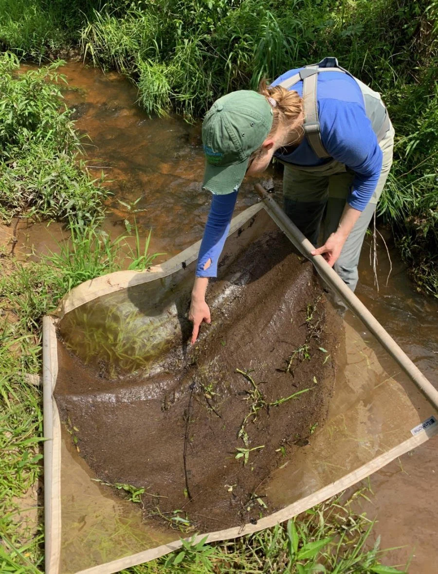
Macroinvertebrate Surveys
You mentioned conducting these surveys on a previous phone call and it's an excellent idea! 15 years ago I actually developed the Tribe's macroinversebrate sampling propotcols so I have the SOP's approved by EPA all ready to go for that. It's the protocol that Prairie Island and Lower Sioux currently use. A macroinvertebrate survey fits perfectly into the COF grant goals. I also have the laboratory set up to process these samples following the protocols. These surveys give a quality of health designation (IBI Score) for each wetland and the river so very helpful!
Estimated Cost: $25,000
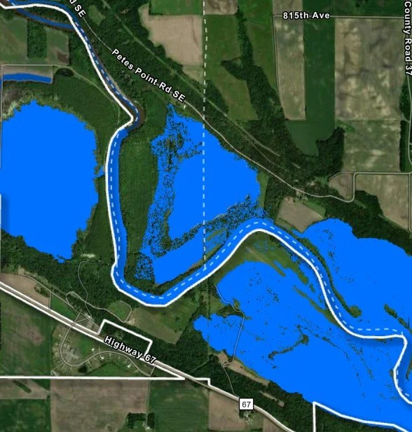
Flood Modeling of River/Wetlands
Develop a flood modeling and visualization tool to support planning, emergency response, and land management decisions on Tribal lands. This project will produce an interactive, web-based GIS map application that allows Tribal staff to select river water levels and visualize corresponding flood extents across Tribal lands. The application will translate complex flood modeling data into an intuitive decision-support tool accessible to non-technical users. When I worked at Prairie Island I used this modeling feature every single day in the spring when the river was flooded. The example prototype I put together for you is just 3 river level layers but the final product would be around 50 layers for each 1/2 foot contour. I think you and the council would benefit from this flooding app immensely!
Estimated Cost: Approximately $15,000
Note: We can work on this ASAP under the Technical Support contract we currently have in place. We can get it ready to use for this springs flooding season. I think there’s leftover funds from past COF grants or we can use funds from the EPA PPG grant since there was a gap in filling the Environmental Specialist position.
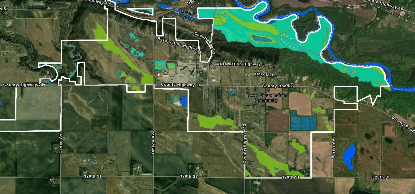
Develop a Wetland Delineation Interactive Map
The NWI was originally developed in the 1970's and obviously very outdated. Developing a detailed high resolution NWI for the Tribe to make decisions on development and to minimize impacts on wetland would be immensely helpful. We just developed one of these for the Lower Sioux- It includes on-the-ground delineation surveys for each wetland, determining the plants in each wetland, collecting an aerial drone picture, site photos, completing the formal delineation forms, listing the wetland determination and the surrounding land use that impacts it. I can train your new employee on helping collect GIS data with the drone while we conduct the site surveys.
Here is the one we built for Lower Sioux.
Estimated Cost: Approximately $35,000
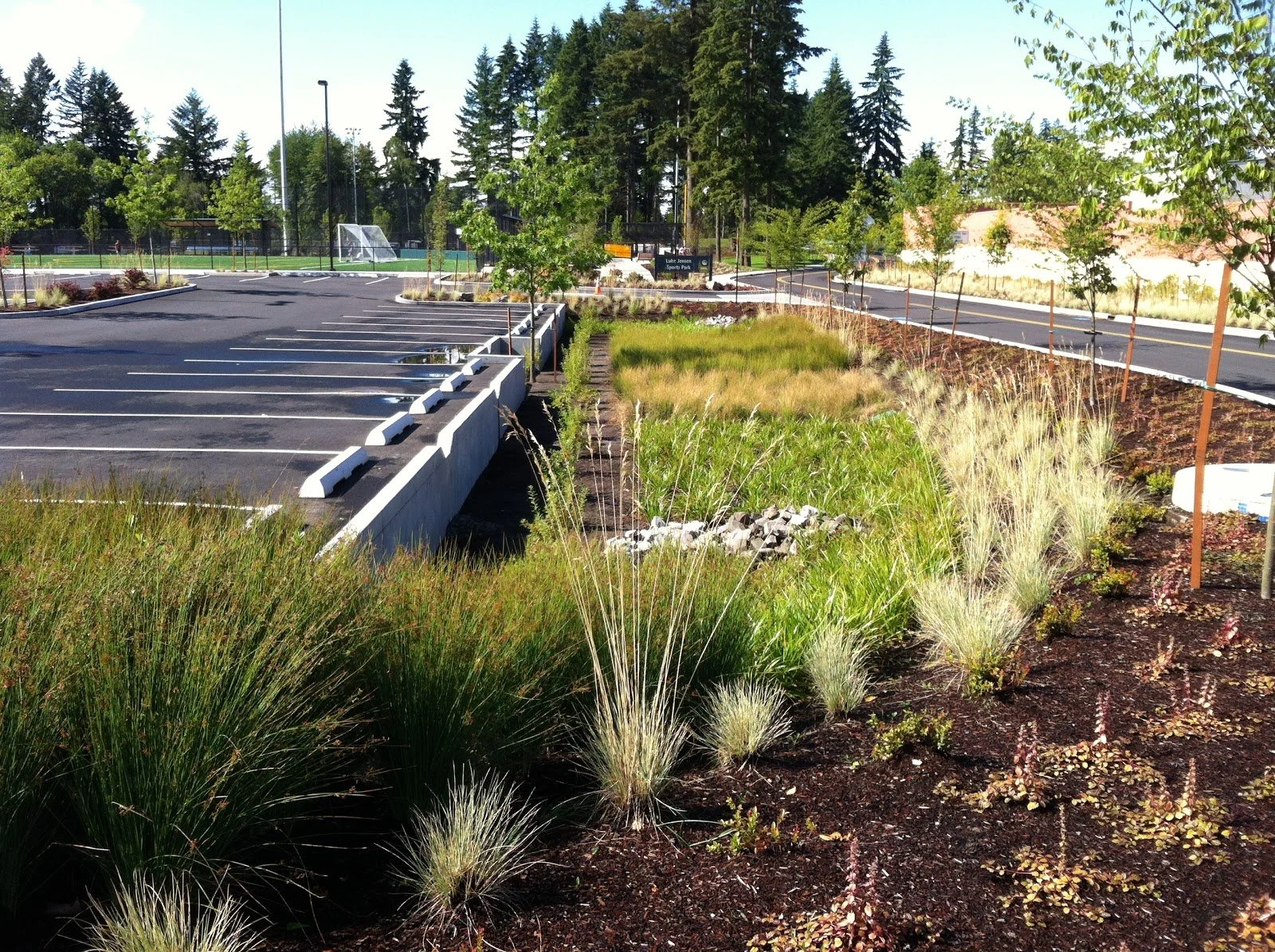
Install Pocket Prairies and/or Rain Gardens
Install native pocket prairies and rain gardens that restore local ecosystems with a focus on planting Dakota cultural plants. The projects will prioritize regionally native species that are culturally significant to the Dakota people—such as plants used traditionally for food, medicine, fiber, and ceremony—while also providing critical ecological benefits like pollinator habitat, improved soil health, and stormwater filtration. These pocket prairies and rain gardens can serve as living landscapes that manage runoff, increase climate resilience, and create opportunities for education.
Estimated Cost: Approximately $35,000
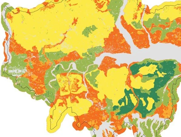
Plant Community/Habitat/Land Classification Map
Develop a land/plant community classification map showing the Tribe's land use and plant/habitat communities. It would categorize the location and how many acres of each habitat such as hardwood forests, riverbottom forest stands, prairie, wetland, oak savanna, residential, commercial, farmland, buffalo project area, urban/commercial land use and more. This would be helpful for tracking restoration projects such as prairie restoration, wild rice restoration and more. Your new GIS guy can help use collect all the GIS data for this project.
Estimated Cost: Approximately $20,000